Use spatial data as the foundation
PostGIS powers both QGIS analysis and web delivery, keeping the map connected to the underlying spatial model.
CASE STUDY 02 / GIS & data
A living map of the land.
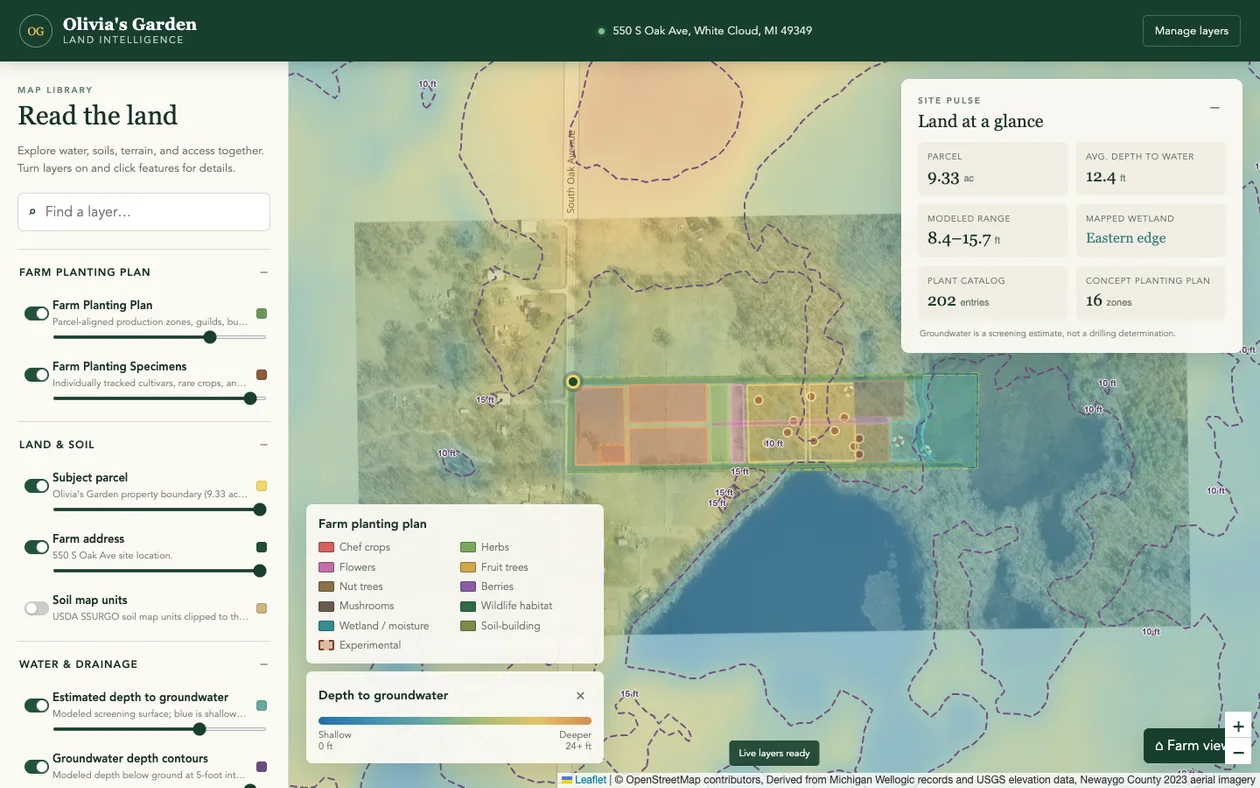
Parcel-scale land intelligence that brings groundwater, soils, wetlands, and farm planning into a single interactive map.
Spatial data engineering · Map interfaces · Domain modeling
01 / THE CHALLENGE
A farm plan needs more than a parcel boundary. Soils, water, wetlands, terrain, and crop requirements exist in separate datasets, making it difficult to see where a proposed planting actually fits.
02 / THE SOLUTION
An extensible GeoDjango application serves spatial features from PostGIS into a Leaflet map. A database-backed layer catalog brings the site’s evidence together, while a normalized crop catalog and parcel-aligned planting zones connect analysis with ongoing farm planning.
03 / ENGINEERING DECISIONS
PostGIS powers both QGIS analysis and web delivery, keeping the map connected to the underlying spatial model.
Public GeoJSON returns approved fields. Staff-only tools support editing, and private well owner information is excluded from public responses.
Geometry validation keeps ordinary production uses inside the parcel and outside mapped wetland constraints and the planning buffer.
04 / WHAT IT DELIVERS
A land-intelligence application with a 202-entry crop catalog, 16 planting zones, specimen tracking, annual planting history, and field observations. The groundwater layer is a screening model, not a site investigation.
Explore oliviasgarden.datapointgis.com ↗ (opens in a new tab)THE NEXT CHAPTER
MICHIGAN / WORKING EVERYWHEREHave a challenging problem or a role in mind?
I’d like to hear about it.